AI for Biodiversity Monitoring
Overview
The NBFC Pilot Demonstrator showcases the practical use of the BAIH Platform in real biodiversity monitoring scenarios, applying Artificial Intelligence and Earth Observation (EO) techniques.
Developed by our team, the pilots use satellite imagery and aerial survey data collected within two areas of the Parco Naturale delle Alpi Marittime — Vej del Bouc and Selle Carnino.
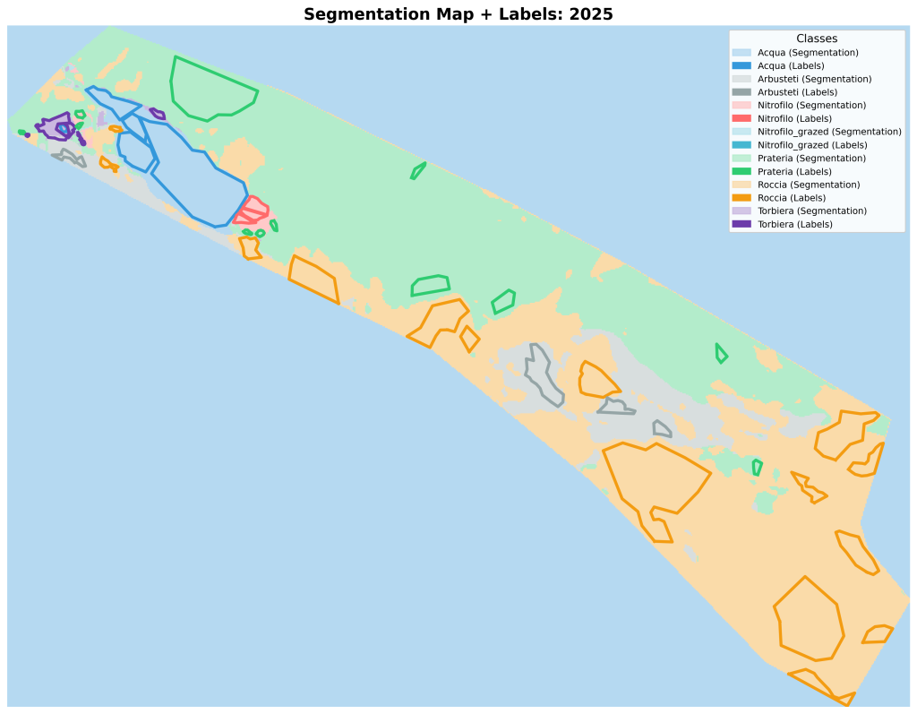
Leveraging the BAIH Platform’s AI workflows, data pipelines, and interactive visualization tools, the pilots identify, classify, and track vegetation types, with a specific focus on Nitrofilo and Torbiera habitats, key ecological indicators in wetland and grassland ecosystems
These pilots demonstrates how the BAIH Platform can transform biodiversity monitoring by applying Earth Observation techniques and advanced AI to real-world scenarios.
Goals
🌱 Automatically detect and classify vegetation types (e.g., “Nitrofilo” and “Torbiera” habitats) using high-resolution aerial imagery.
📈 Monitor ecosystem changes across space and time by aggregating multi-temporal and multi-model data.
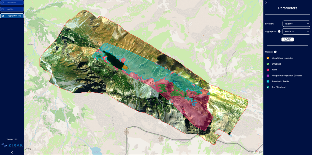
🖥️ Provide ecologists and environmental managers with an interactive dashboard that combines quantitative metrics and visual insights to support biodiversity assessment and interpretation.
Architecture
The NBFC Pilot is powered by a robust modular architecture designed for scalability and transparency:
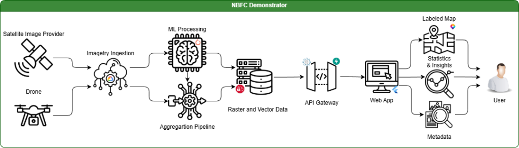
How it works
-
Data acquisition – Aerial imagery (and satellite data where relevant) is collected and pre-processed through the BAIH data pipeline.
-
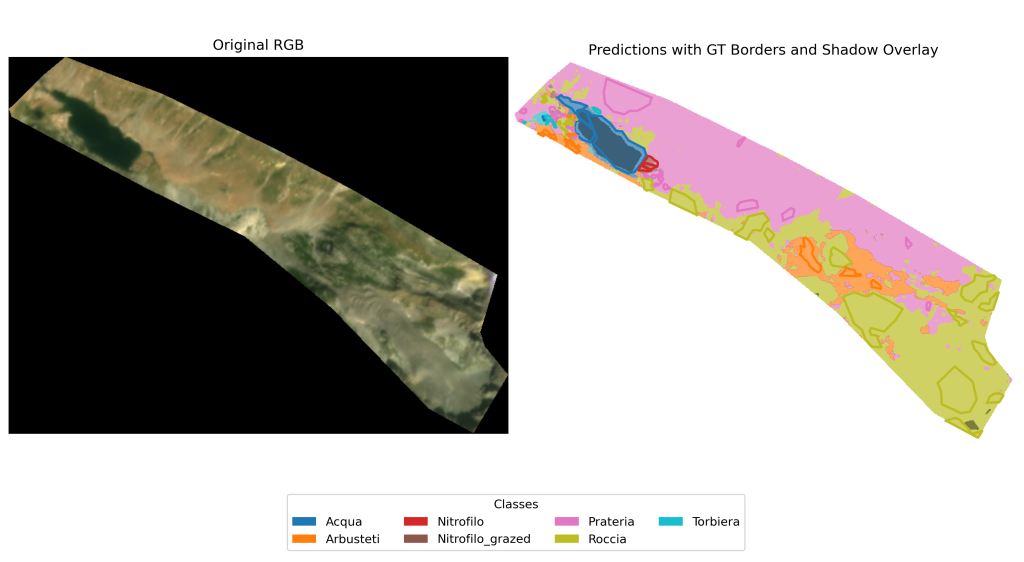
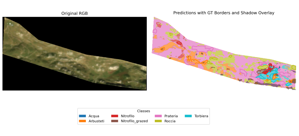
Model inference – Machine-learning models perform pixel-level classification, generating thematic maps and biodiversity indicators.
-
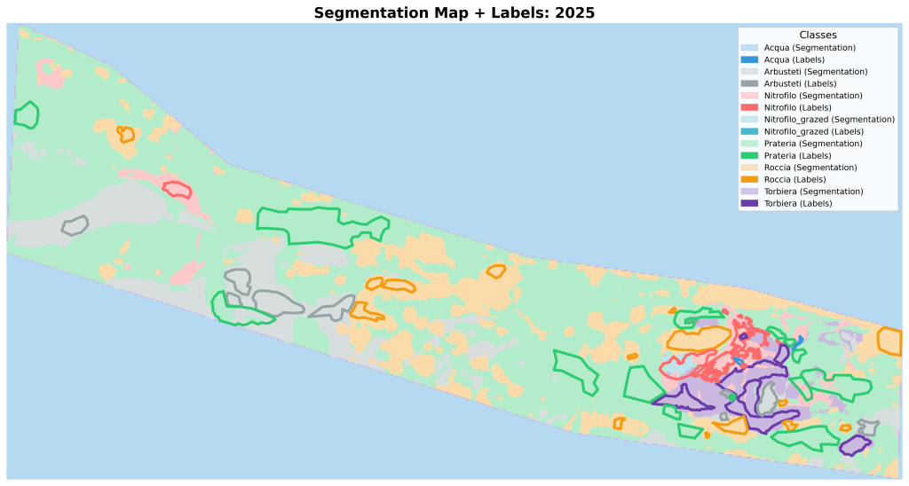
Aggregation – Results from multiple models and time periods are combined to enhance accuracy, consistency, and reliability.
-
Interactive visualisation – A unified web dashboard displays classification overlays, species-coverage metrics, and temporal or model-based comparison tools.
Innovation and impact
- Bridging AI and ecological fieldwork – The platform integrates state-of-the-art AI research with on-the-ground ecological knowledge, making biodiversity monitoring scalable and replicable.
- Multi-scale data integration – By combining aerial observations with satellite data, the pilot offers a richer and more holistic understanding of environmental conditions at varying scales.
- Actionable insights for researchers – The system delivers precise, visual and quantitative information that supports the interpretation of ecosystem dynamics and the tracking of biodiversity trends.
The NBFC Pilot is powered by a robust modular architecture designed for scalability and transparency:
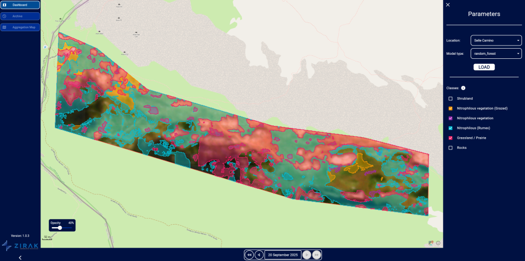
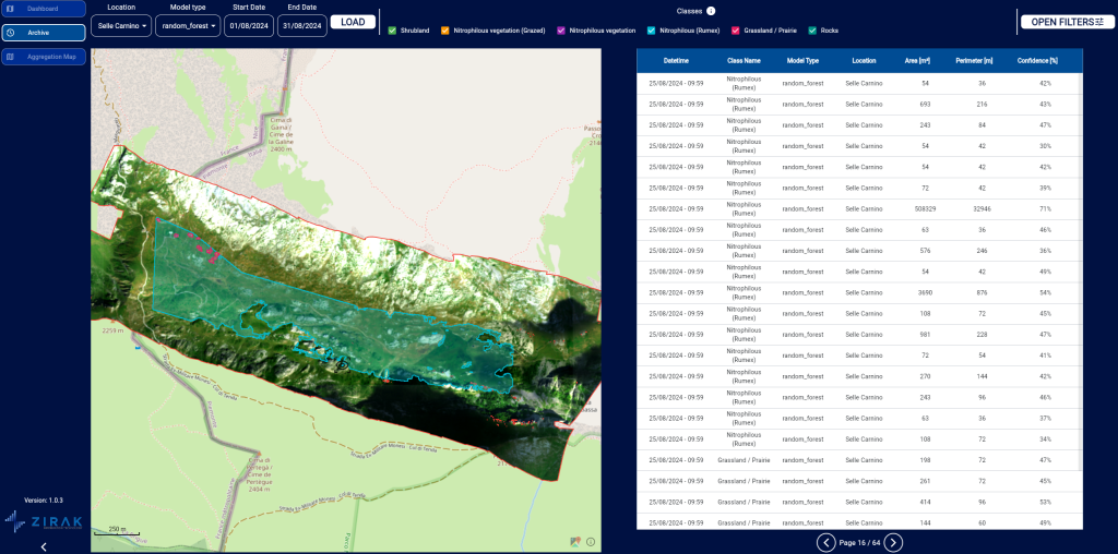
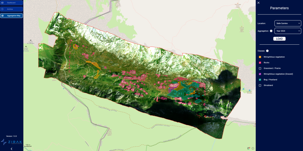
BAIH Platform in Action – Pilot snapshots
Our partners